Paro (Paro)
Paro (སྤ་རོ་) is a town and seat of Paro District, in the Paro Valley of Bhutan. It is a historic town with many sacred sites and historical buildings scattered throughout the area. It is also home to Paro International Airport, Bhutan's sole international airport. Paro International Airport is served by Drukair.
The main street has many examples of traditionally decorated buildings.
The Dungtse Lhakhang (a 15th-century temple) and the Ugyen Perli Palace are near the new bridge. Members of royal family lodge in the palace when in Paro. Nearby is the old bridge and the Rinpung Dzong. Notable hotels include the Olathang Hotel built in an ornate style.
About 10 km outside Paro is the famous Paro Taktsang (Tiger's Nest) Buddhist monastery and hermitage. Some Bhutanese believe that Padmasambhava (Guru Rinpoche) flew on the back of a tigress to this location from Tibet. The trek to Tiger's Nest monastery takes about three hours one way. A scenic view of the town of Paro can be seen from the Tiger's Nest. A 16 km road passes up the valley to the ruins of another fortress-monastery, Drukyel Dzong, which was partly destroyed by fire in 1951.
Paro is home to Bhutan's tallest building, the Ta-Dzhong, which is 22 meters (72 feet) high, and has 6 floors. It was completed in 1649.
Map - Paro (Paro)
Map
Country - Bhutan
 |
 |
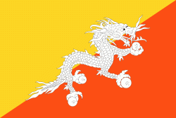
| Flag of Bhutan | |
The subalpine Himalayan mountains in the north rise from the country's lush subtropical plains in the south. In the Bhutanese Himalayas, there are peaks higher than 7000 m above sea level. Gangkhar Puensum is Bhutan's highest peak and is the highest unclimbed mountain in the world. The wildlife of Bhutan is notable for its diversity, including the Himalayan takin and golden langur. The capital and largest city is Thimphu, holding close to 1/7th of the population.
Currency / Language
| ISO | Currency | Symbol | Significant figures |
|---|---|---|---|
| BTN | Bhutanese ngultrum | Nu | 2 |
| INR | Indian rupee | ₹ | 2 |
| ISO | Language |
|---|---|
| DZ | Dzongkha language |


